
Key Highlights:
✔ Historic Collaboration – NISAR is a joint mission by ISRO & NASA, marking a major milestone in India-US space ties.
✔ Earth Under Scanner – The satellite will study land shifts, glaciers, forests, and oceans with unprecedented precision.
✔ Decade in Making – Developed over 8-10 years, NISAR will operate for 5 years in a Sun-synchronous orbit.
India & US Make Space History with NISAR Launch
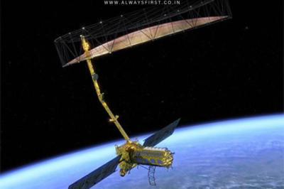
In a landmark moment for global space exploration, India and the United States are set to launch the NISAR satellite today—a revolutionary Earth-observing mission developed jointly by ISRO and NASA. The satellite, short for NASA-ISRO Synthetic Aperture Radar, represents years of collaboration, blending expertise from both nations to unlock new secrets about our planet.
When & Where Is NISAR Launching?
The countdown for the GSLV-F16/NISAR mission began on July 29, with liftoff scheduled for 5:40 PM today from Sriharikota’s second launch pad, about 135 km from Chennai. Standing tall on a 51.7-meter GSLV rocket, the 2,393 kg satellite will embark on its five-year journey to scan Earth from a Sun-synchronous orbit.
ISRO confirmed the launch readiness in a recent post on X (formerly Twitter):
*”GSLV-F16 is standing tall on the launch pad. NISAR is ready. Liftoff today!”*
What Will NISAR Study?
NISAR’s advanced radar technology will provide high-resolution data on critical environmental changes, including:
- Land & Ice Deformation – Tracking shifts in glaciers (Himalayas, Antarctica, polar regions).
- Forest & Ecosystem Changes – Monitoring seasonal variations in global forests.
- Ocean Dynamics – Studying coastal and deep-sea movements.
This data will be shared with the global scientific community, aiding climate research and disaster management.
A Decade in the Making
The mission has been a massive technical endeavor, with ISRO and NASA engineers working together for 8-10 years to design the satellite’s complex radar systems. While ISRO built the spacecraft and launch vehicle, NASA contributed the L-band radar, GPS receiver, and high-speed data downlink systems.
What Happens After Launch?
The first 90 days will focus on satellite commissioning, ensuring all systems function optimally. Once operational, ground stations in India and the US will download and process images for researchers worldwide.
This mission not only strengthens Indo-US space relations but also sets a new benchmark for international scientific collaboration. Stay tuned for updates as NISAR begins its journey to decode Earth’s hidden mysteries.


Leave a Reply