
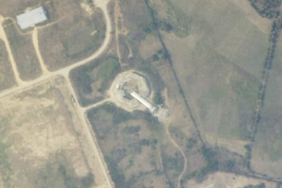
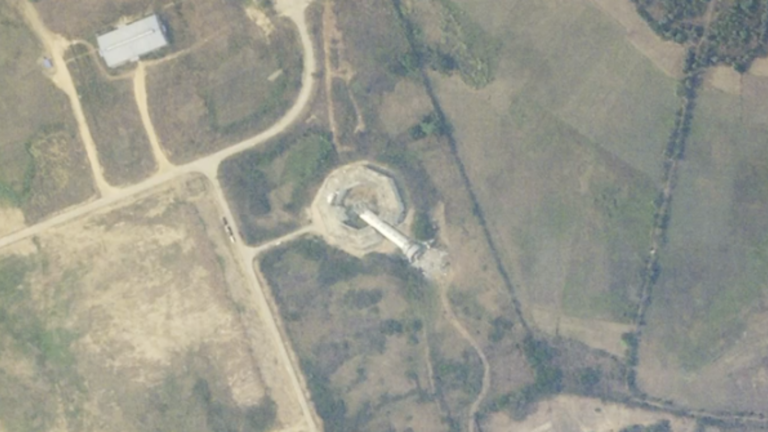
- ISRO’s Cartosat-3 captured devastating before-and-after images of Myanmar’s Ava Bridge collapse.
- Over 2,900 people have died, with thousands injured and missing as rescue efforts continue.
- The quake and aftershock caused severe damage to Mandalay, Sagaing, and historic landmarks.
How Bad Was the Earthquake’s Impact?
The 6.4-magnitude earthquake struck near the Sagaing-Mandalay border at a shallow depth of 10 kilometers, making its impact even more destructive. The Ava Bridge, a crucial link between regions, collapsed, as seen in ISRO’s satellite images. Mandalay, Myanmar’s second-largest city, suffered heavy losses, including damage to the famous Mahamuni Pagoda. Tremors were felt as far as Chiang Mai, Thailand, triggering emergency responses across the region.
Adding to the devastation, a powerful aftershock worsened the destruction, causing further building collapses and more casualties. The death toll has surged past 2,900, with thousands still missing.
What’s Happening Now?
Myanmar’s military government has declared a state of emergency, but relief efforts are being hampered by ongoing civil conflicts. Rescuers are struggling to reach survivors trapped under debris, while international humanitarian organizations are stepping in to provide aid.
The earthquake has also raised alarms about future seismic threats, as the Sagaing Fault remains highly active due to the collision of the Indian and Eurasian tectonic plates. While relief operations continue, experts warn that Myanmar needs better preparedness to handle future disasters of this scale.


Leave a Reply